Welcome to Dragoneye Digital, your premier destination for cutting-edge drone survey deliverables. Our platform empowers industries with advanced UAV mapping solutions, 3D modeling, and comprehensive aerial analytics to enhance project efficiency and accuracy.
UAV Mapping Solutions:
Leverage our state-of-the-art UAV mapping services to obtain precise aerial surveys, facilitating informed decision-making for your projects.
3D Modeling:
Transform your site data into detailed 3D models, providing a comprehensive perspective for planning and analysis.
Aerial Analytics:
Access in-depth aerial analytics to monitor progress, assess site conditions, and optimize resource management.
Capture and explore your project in 3D.
Dragoneye supports wide area surveys, such as a large tract of land undergoing development, a quarry or agricultural land as well as close range inspection of buildings or other infrastructure.
Data Aquisition
No drone? No worries. We can provide drone flight planning and data aquisition services from our network of accredited pilots.
Processing
Upload your images and positioning data, and we'll take care of the rest. dragoneye supports RGB, thermal and multispectral data.
View and Inspect
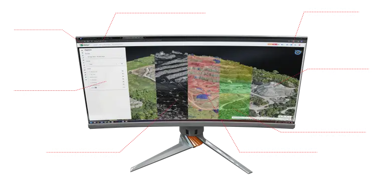
View your survey or inspection in 3D with our secure cloud-hosted, browser-based solution.
Measure
See the evolution of a site over time or compare construction progress with an imported plan.
Compare and Contrast
See the evolution of a site over time by comparing survey to survey, or compare construction progress with an imported plan with the ability to use both 3 dimensional models and line drawings.
Report and Share
Build a material stockpile report, a dynamic risk assessment or condition report of a building or infrastructure and share your findings with other members of your team.
Enjoy a Unique View of Your Projects
Comparisons
Compare many aspects of projects survey to survey & survey to plan.
Including
- Heatmap comparison
- 3D Direct comparison
- Cross section comparison
- Volume comparison
- Survey to Survey
- Survey to Plan
Measurement Tools
Measure anything you can see using a point, line, or polygon.
Including
- Elevation History
- Cross Section
- Bund Check
- Road Grade
- Distance Check
- Height Difference
- Volume
- Cut & Fill
Volumes & Stock
Our surveys include the ability to measure volume stock or blast volumes and more.
Including
- Blast Volume Analysis
- Stock Pile Measurements
- Stock Pile Reporting
- Material Listing
- Cut and Fill Against Plan
- Cut & Fill Average
- Ground Plain Analysis
- Centimetre Accurate Maps & Models
- Digital Surface and Digital Terrain Modeling
- Compare Survey Against Survey
- Compare Survey Against Drawings and Plans
- Measure Anything you can See
- Seamless Sharing with Colleagues and Contractors
- Quick and Effective Data Collection
- Quick and Effective Processing and Delivery
- Export Simplified Models, Grids, and Contours
- Have a Complete Golden Record of your Project
Industries
Construction
Construction
Building Inspection
Insurance
